
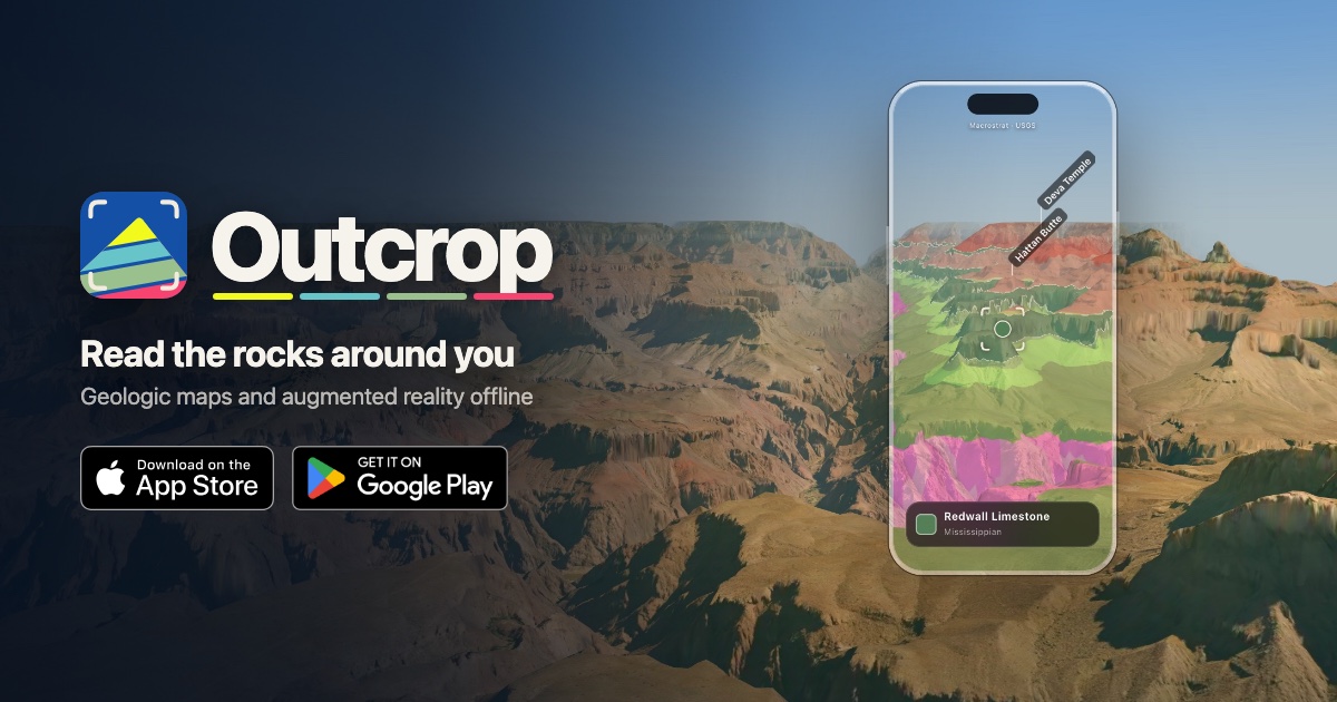
Point your camera at a landscape to learn about its geology
Point your camera at the landscape around you to learn about its geology: what the rocks are, when and how they formed, and where the continents were at the time. It also works offline.
Quick read
Outcrop is a mobile geology app that overlays geologic maps onto the real world using your phone camera. You would visit to identify local rocks, view their ages and origins, and explore past plate positions and stratigraphy in augmented reality.
- Identify the rock under your feet with name, age and formation
- View geologic maps and labels overlaid on the landscape camera
- Play paleogeographic maps to see past plate positions and movement
Reactions
No reactions yet. Record a short about this link and it shows up here, in Reels and in the community feed.
Is outcrop.rocks your site? Sign in to verify it and get a Verified badge, full stats and a link-back badge.
A closer look at Point your camera at a landscape to learn about its geology
What Outcrop does on your phone
Outcrop is a geology app for iPhone and Android that overlays geologic maps in augmented reality when you point your camera at the landscape around you.
It identifies the rock in the center of the screen, labels nearby peaks and lakes, and lets you tap a rock to highlight it while graying out everything else.
Maps, timelines and plate reconstructions
The app shows where each rock fits in Earth’s 4.5-billion-year history with a timeline you can hover over or tap to see periods and events.
Where Macrostrat has a stratigraphic column for an area, you can view subsurface layers, their ages, gaps in the record and fossils; you can also see the globe as it looked when a rock formed using Christopher Scotese’s PALEOMAP maps and play an animation of plate motion.
Layers, search and offline use
Outcrop uses bedrock and fault data from Macrostrat, and offers Quaternary geology and Soils layers (the latter show soil and plants) that work both on the map and in the camera view.
You can search for rock types, ages, named units or faults, highlight matching places and find how far the nearest match is, and you can outline and download an area so the map and camera view work offline (fossil records and active faults in camera view still need a connection).
Who will find Outcrop useful
People who want to identify and learn about rocks and local geology in the field will find the app practical, including those interested in stratigraphy, faults, soils or seeing past plate positions.
It’s set up for use at outcrops like canyon walls, road cuts or ridges and for exploring both nearby ground and more distant features labeled on the map.
Questions people ask about Point your camera at a landscape to learn about its geology
- Do I need a connection to use Outcrop in the field?
- You can download an outlined area so the map and camera view work without a signal, but fossil records and active faults in the camera view still require a connection.
- What geographic data does Outcrop use?
- Bedrock and faults come from Macrostrat, and paleogeographic reconstructions use Christopher Scotese’s PALEOMAP maps.
- Where can I get the app?
- Outcrop is available on the App Store and Google Play.
Point your camera at a landscape to learn about its geology was shared on NexURLs by Nexis on November 2, 2026, in Travel & Places.
What we found on this site
- Served through
- Cloudflare
- Home page answered in
- 239 ms
- Trackers
- None found
- Ads
- None found
- RSS feed
- No
- AI crawlers
- Lets them in
- Set up for phones
- Yes
- Real-visitor speed
- Not enough visitors for Google data
- Popularity
- Top 200,000 domain (Cloudflare)
- Google safety check
- No threats found
- Domain registered
- 2026
- Domain renews
- October 2027
Checked November 2, 2026 from the site’s own code and public records. See how the rest of the web compares in the NexURLs Internet Report.
Quick answers
What is Point your camera at a landscape to learn about its geology?
Point your camera at a landscape to learn about its geology (outcrop.rocks): Outcrop is a mobile geology app that overlays geologic maps onto the real world using your phone camera. You would visit to identify local rocks, view their ages and origins, and explore past plate positions and stratigraphy in augmented reality.
Who shared Point your camera at a landscape to learn about its geology on NexURLs?
It was shared by Nexis in November 2026. Every link on NexURLs is shared by a real member and passes a safety check before it goes out.
What are some sites like Point your camera at a landscape to learn about its geology?
Members found these close to it: Earth View, EarthCam, Mapillary. The full list is on this page under Sites like Point your camera at a landscape to learn about its geology.
Sites like Point your camera at a landscape to learn about its geology
- Earth Viewearthview.withgoogle.com
- EarthCamearthcam.com
EarthCam is a network of live streaming webcams showing tourism and entertainment scenes worldwide using 4K streaming...
- Mapillarymapillary.com
- Google Mapsgoogle.com
- GeoGebrageogebra.org
GeoGebra is a free interactive mathematics platform offering calculators, geometry tools, 3D visualizations, lessons...
- Lizard Point Quizzeslizardpoint.com
A site offering clickable map geography quizzes for learners at many grade levels. Visit to practice map skills and...
More Travel & Places finds
- Earth Trekkersearthtrekkers.com
- World Beach Guideworldbeachguide.com
- Walk Scorewalkscore.com
- AeroLOPAaerolopa.com
- Passport Indexpassportindex.org
- Budget Your Tripbudgetyourtrip.com
Feeling lucky? Try the random website generator.
Where people went next
Nobody has added a next stop yet. Be the first.